
March 30, 2026
In a major advancement for pandemic preparedness, researchers from the Chinese Academy of Sciences have unveiled a groundbreaking global map that pinpoints specific “hotspots” where avian influenza is most likely to jump from wild birds to domestic animals and humans. Published March 9, 2026, in Nature Communications, the study reveals that while these high-risk zones cover only 14% of the Earth’s land surface, they contain a massive concentration of the world’s poultry, cattle, and human populations.
By analyzing the migratory patterns of nearly 800 waterbird species, the research offers a predictive “early warning system” at a critical moment. The world is currently grappling with persistent H5N1 outbreaks in U.S. dairy cows and poultry worldwide, raising urgent questions about where the virus might evolve next.
Tracking the “Entropy” of Viral Spread
The core innovation of the study is a new metric called Waterbird Activity Entropy (WAE). Rather than looking at where birds are at a single point in time, WAE measures the diversity, duration, and turnover of bird species month by month.
Think of these hotspots as busy international airport hubs. In areas with high WAE, different species of wild birds—the natural reservoirs for avian flu—arrive, mingle, and depart at high frequencies. This constant “shuffling” creates a genetic mixing bowl where viruses can easily circulate, mutate, and eventually spill over into nearby farms.
The researchers tested their model against historical data and found it achieved an impressive 87% accuracy (0.87 AUC) in predicting where H5N1 and other highly pathogenic strains had actually emerged. This dynamic approach allows health officials to see how risk shifts seasonally as birds migrate, a significant improvement over previous static maps.
The Four Primary Hotspots
The study identifies four regions that represent the highest risk for a major “spillover” event:
-
The United States
-
The European Union
-
China
-
India
Together, these four regions house 52% of the world’s exposed human population, 41% of the world’s cattle, and 51% of its poultry. The danger in these areas stems from “tight squeezing”—the close proximity of dense industrial farming, expanding urban centers, and natural wetlands.
In the U.S., for example, the H5N1 virus has ravaged poultry and dairy herds since 2022. The new mapping explains why: many large-scale farms are situated directly in the path of high-activity migratory flyways.
The “Ticking Clock” in Sub-Saharan Africa
While the major economic powers face high exposure, the researchers flagged Sub-Saharan Africa as a region of profound concern. This area accounts for 15% of the world’s identified hotspot land, yet it has reported less than 1% of global avian flu cases.
This discrepancy suggests a massive “surveillance gap.” Experts fear that the virus may be circulating undetected in African wetlands and local livestock, much like the early stages of the H5N1 crisis in Asia two decades ago.
“Hotspots flag exposure odds, not inevitability; biosecurity and rapid testing matter more,” says Dr. Thijs Kuiken, a pathologist at Erasmus Medical Center who was not involved in the study. He describes the lack of data in Africa as a “ticking clock” for global health security.
Current Landscape: From Birds to Bovines
The H5N1 virus has come a long way since its detection in 1996. It is now considered a “panzootic”—a pandemic among animals—affecting species ranging from sea lions to grizzly bears.
As of early 2026, the situation has grown more complex with the infection of dairy cows. Infected cattle shed high concentrations of the virus in their milk. While the Centers for Disease Control and Prevention (CDC) and World Health Organization (WHO) maintain that the risk to the general public remains low, the adaptation of the virus to mammals heightens concerns about its potential to eventually spread between humans.
Since 2003, there have been 994 confirmed human cases of H5N1 globally, with a case fatality rate of approximately 48%. While recent cases in the U.S. linked to dairy farm exposure have been mild, the high mortality rate of the virus historically keeps scientists on high alert.
Expert Perspectives
Outside experts have praised the study for its practical utility. Dr. Marion Koopmans, a world-renowned virologist at Erasmus Medical Center, notes that the WAE approach is superior because it captures the “fluidity” of bird movement.
“This approach smartly captures bird dynamics that static models miss,” Dr. Koopmans says. “It allows us to prioritize surveillance where overlaps are tightest—like U.S. Midwest farms or Indian live markets.”
What This Means for You
While the mapping is a tool for governments and scientists, it carries practical implications for the health-conscious consumer, particularly those living in identified hotspots:
-
Food Safety: Avoid raw (unpasteurized) milk and ensure poultry and eggs are cooked to an internal temperature of 165°F (74°C). Pasteurization and proper cooking effectively kill the H5N1 virus.
-
Animal Contact: Avoid unprotected contact with sick or dead wild birds. If you keep backyard poultry, ensure their feed and water are protected from wild bird droppings.
-
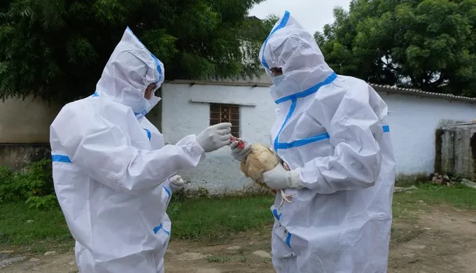
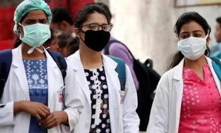
Worker Safety: Healthcare workers and farm employees in hotspot zones should strictly adhere to Personal Protective Equipment (PPE) protocols when dealing with potential respiratory illnesses or animal outbreaks.
Limitations of the Research
No model is perfect. The study’s reliance on existing bird records means that in data-poor regions, the risk may be underestimated. Furthermore, a “hotspot” only indicates a higher probability of exposure—it does not guarantee an outbreak. Factors such as farm hygiene (biosecurity), local climate, and the specific strain of the virus all play roles in whether a spillover actually occurs.
The Path Forward
The “One Health” approach—which recognizes that the health of people is closely connected to the health of animals and our shared environment—is the backbone of this new research. By identifying where these three worlds collide, policymakers can better direct resources.
For countries like India and China, where poultry is vital to food security and livelihoods, these maps could prevent the culling of millions of birds through early vaccination and targeted monitoring. Ultimately, bridging the surveillance gaps—from the dairies of the American Midwest to the wetlands of Sub-Saharan Africa—is the world’s best defense against the next pandemic.
Medical Disclaimer: This article is for informational purposes only and should not be considered medical advice. Always consult with qualified healthcare professionals before making any health-related decisions or changes to your treatment plan. The information presented here is based on current research and expert opinions, which may evolve as new evidence emerges.
References
Study Citations:
-
Li, Y., Qiao, Y., Zhan, Y. et al. “Mapping global avian influenza risk patterns through waterbird activity entropy.” Nature Communications (March 9, 2026). https://doi.org/10.1038/s41467-026-70432-0


